Mapping Made More Sense with Mapline
February 13, 2014 (PRLEAP.COM) Technology News
What do popular companies like Salesforce.com, SAP, Walmart, UPS, Wells Fargo, and others have in common? All of them rely to Mapline as their only source of timely data analysis with the help of powerful maps. Last January 13, 2014, the leading online mapping site had announced its rebranding of services including its name. The team behind the company understands that its previous name, "Topo.ly" is plain hard to remember and equally harder to pronounce. Hence, "Mapline" was born to help users create a map from their Excel data. Inez Steele from Realty Guild, is one of the thousand satisfied users of the leading online mapping site. She said that Mapline "… is the easiest, most affordable and most flexible mapping solution for my website I could find. Within 30 minutes I had my map up and when I hit a snag, customer service was right there to help. Thanks Topo.ly for making what I thought would be a mega job into something so easy!"
New Name, Better Mapping Experience
Map Creation in Minutes
Mapline users can create a map from their Excel data in just a few minutes. Because of enhanced mapping technology, users can just paste address locations from their spreadsheets. In less than 3 minutes, maps are available to view for advanced analysis and better data visualization.
Map Sharing
Mapline users can share maps for better team collaboration. Whether team members are in the same room or located in different parts of the world, maps can now be shared in just a few clicks.
Map for Website
Most organizations are likely to use Mapline feature of embedding map on their website. Now, embedding maps can be accomplished within minutes..
Map Markers Customization
Plus users can change their map markers and adjust their sizes, colors, and shapes. They can even upload a custom image. This is helpful for enhanced analysis. When this feature is applied, connections between data sets can be easily distinguished.
Show Location Labels
Mapline users can display the name or label of each of their address location in just one click. Many find this greatly beneficial especially when the maps are used for PowerPoint presentation or map printing.
Map Filter Option
Mapline's filter option is used to view locations by segmented categories. This is great for deep analysis by data classifications.
Heatmap
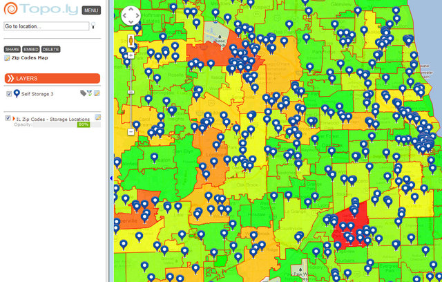
The heatmapping feature using sets of territory boundaries is another reason why most Plus users keep on using Mapline. feature using particular set of territory boundaries. Using this feature allows the Plus users to make analysis of location density, total sales, and others.
High Data Security
Mapline is dedicated to customers' privacy. Hence, data is 100% protected. To do this, all users' information like their maps and data are always private by default. Only the users can access their accounts. In addition, the online mapping site added a secure https connection to increase the security of your connection.
